winter

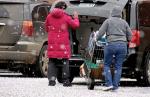
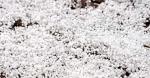
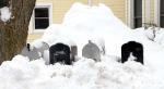
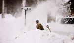
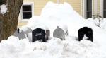
The weekend storm began on Friday with small hailstones that pelted Minneota. Karen Swedzinski of Brad’s Market delivered groceries to the car of Margrit Rabaey as the hail pelted down., Friday's hail before the snow. , Snow was piled up all over and after the plows came through it couldn’t be easy for the mailman to reach the boxes on Madison Street. , The community was stranded indoors on Saturday as the huge storm forced the closing of businesses and as well as all the roads in the area. ,

Everyone knew it was coming.

The weatherman let everyone know a “big blast” of winter was going to interrupt the spring we haven’t had — one more time!

But when it was finally unleashed, it came in just about every form imaginable. On Friday, thunder, lightning and even HAIL pelted down in sheets.

“Haven’t seen much hail this time of year,” one old-timer bellowed. He was right. It is unusual. But it was only the beginning.

On Saturday, the snow began early and continued on through the evening hours — dumping up to 19 inches of snow in the Minneota area. Canby reported 24 inches of snow. The Twin Cities had 15 to 19 inches.

“I’ve seen this four times in my time on the city crew,” said Maintenance man Jeff Yeo.

“Motorists are advised not to...
A winter storm warning is in effect until 9 p.m. Tuesday night.

Here we go again...

WINTER STORM WARNING REMAINS IN EFFECT UNTIL 9 PM CDT THIS EVENING...

* WHAT...Heavy snow. Total snow accumulations of 6 to 9 inches are expected. The amounts of 8 or 9 inches will be in southwest Minnesota, with extreme northwest Iowa closer to 6 inches of snow.

* WHERE...Portions of northwest Iowa and southwest Minnesota.

* WHEN...Until 9 PM CDT this evening

. * ADDITIONAL DETAILS...Plan on very difficult travel conditions, including during the morning commute. Be prepared for significant reductions in visibility, and winds will increase to 25 to 35 mph toward midday.

PRECAUTIONARY/PREPAREDNESS ACTIONS... A Winter Storm Warning for snow means severe winter weather conditions will make travel very hazardous or impossible....

WINTER WEATHER ADVISORY REMAINS IN EFFECT FROM 6 P.M. THIS EVENING TO NOON CST TUESDAY

WINTER WEATHER ADVISORY REMAINS IN EFFECT FROM 6 P.M. THIS EVENING TO NOON CST TUESDAY

* WHAT...Snow expected. Total snow accumulations of 2 to 4 inches are expected.

* WHERE...Portions of central, east central, south central and southeast South Dakota and southwest Minnesota.

* WHEN...From 6 P.M. this evening to noon CST Tuesday.

* ADDITIONAL DETAILS...Plan on slippery road conditions, including during the morning commute on Tuesday. Be prepared for reduced visibilities at times.

PRECAUTIONARY/PREPAREDNESS ACTIONS... A Winter Weather Advisory for snow means periods of snow will cause primarily travel difficulties. Be prepared for snow covered roads and limited visibilities, and use caution while driving.

The latest road conditions for the...

WINTER WEATHER ADVISORY IN EFFECT FROM MIDNIGHT TONIGHT TO 6 PM CST THURSDAY

WINTER WEATHER ADVISORY IN EFFECT FROM MIDNIGHT TONIGHT TO 6 PM CST THURSDAY...

* WHAT... SNOW AND BLOWING SNOW EXPECTED. PLAN ON SLIPPERY ROAD CONDITIONS, INCLUDING DURING THE MORNING COMMUTE ON THURSDAY. TREE BRANCHES COULD FALL AS WELL.

TOTAL SNOW ACCUMULATIONS OF UP TO TWO INCHES ARE EXPECTED.

* WHERE... PORTIONS OF SOUTHWEST MINNESOTA.

* WHEN... FROM MIDNIGHT TONIGHT TO 6 PM CST THURSDAY.

* ADDITIONAL DETAILS... BE PREPARED FOR REDUCED VISIBILITIES AT TIMES. COLD WIND CHILLS AS LOW AS 25 BELOW ZERO LATE TONIGHT AND THURSDAY MORNING WILL CAUSE FROSTBITE IN AS LITTLE AS 30 MINUTES TO EXPOSED SKIN. PRECAUTIONARY/PREPAREDNESS ACTIONS...

A WINTER WEATHER ADVISORY FOR SNOW MEANS PERIODS OF SNOW WILL CAUSE PRIMARILY TRAVEL DIFFICULTIES. BE...

WINTER STORM WATCH IN EFFECT FROM LATE WEDNESDAY NIGHT THROUGH THURSDAY AFTERNOON

WINTER STORM WATCH IN EFFECT FROM LATE WEDNESDAY NIGHT THROUGH THURSDAY AFTERNOON...

* WHAT... BLIZZARD CONDITIONS POSSIBLE. TRAVEL COULD BE VERY DIFFICULT TO IMPOSSIBLE, INCLUDING DURING THE MORNING COMMUTE ON THURSDAY. TOTAL SNOW ACCUMULATIONS OF 3 TO 6 INCHES ARE POSSIBLE.

* WHERE... PORTIONS OF NORTHWEST IOWA AND SOUTHWEST MINNESOTA.

* WHEN... FROM LATE WEDNESDAY NIGHT THROUGH THURSDAY AFTERNOON.

* ADDITIONAL DETAILS... WINDS GUSTING AS HIGH AS 40 MPH COULD CAUSE WHITEOUT CONDITIONS IN BLOWING SNOW. SIGNIFICANT DRIFTING OF THE SNOW IS ALSO POSSIBLE.

COLD WIND CHILLS AS LOW AS 25 BELOW ZERO WILL CAUSE FROSTBITE IN AS LITTLE AS 30 MINUTES TO EXPOSED SKIN. PRECAUTIONARY/PREPAREDNESS ACTIONS...

A WINTER STORM WATCH FOR BLIZZARD CONDITIONS MEANS...

Anthony “Tony” Winter, 95, of Minneota, died on Saturday, June 24, 2017, at the Minneota Manor in Minneota one hour and 49 minutes short of this 95th birthday, surrounded by his loving family.

Mass of Christian Burial for Tony will be at 1 p.m. on Thursday, June 29, at St. Edward Catholic Church in Minneota. Visitation will be Wednesday from 5 p.m. – 8 p.m. with a Rosary at 5 p.m. and a Prayer Service at 7 p.m. at Rehkamp Horvath Funeral Home in Minneota.

Visitation will continue from 11:30 a.m. – 12:30 p.m. Thursday at the funeral home. Interment will take place at St. John Cantius Cemetery in Wilno.

Anthony “Tony” Frank Winter was born on June 25, 1922, and was raised on a farm near Wilno, MN.

He was the seventh child of Frank and Anna (Ott) Winter. Tony...

Contact Us

The Minneota Mascot
Address: 201 N. Jefferson
Minneota, MN 56264

Phone:(507) 872-6492


Site Links